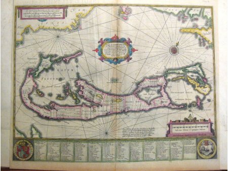
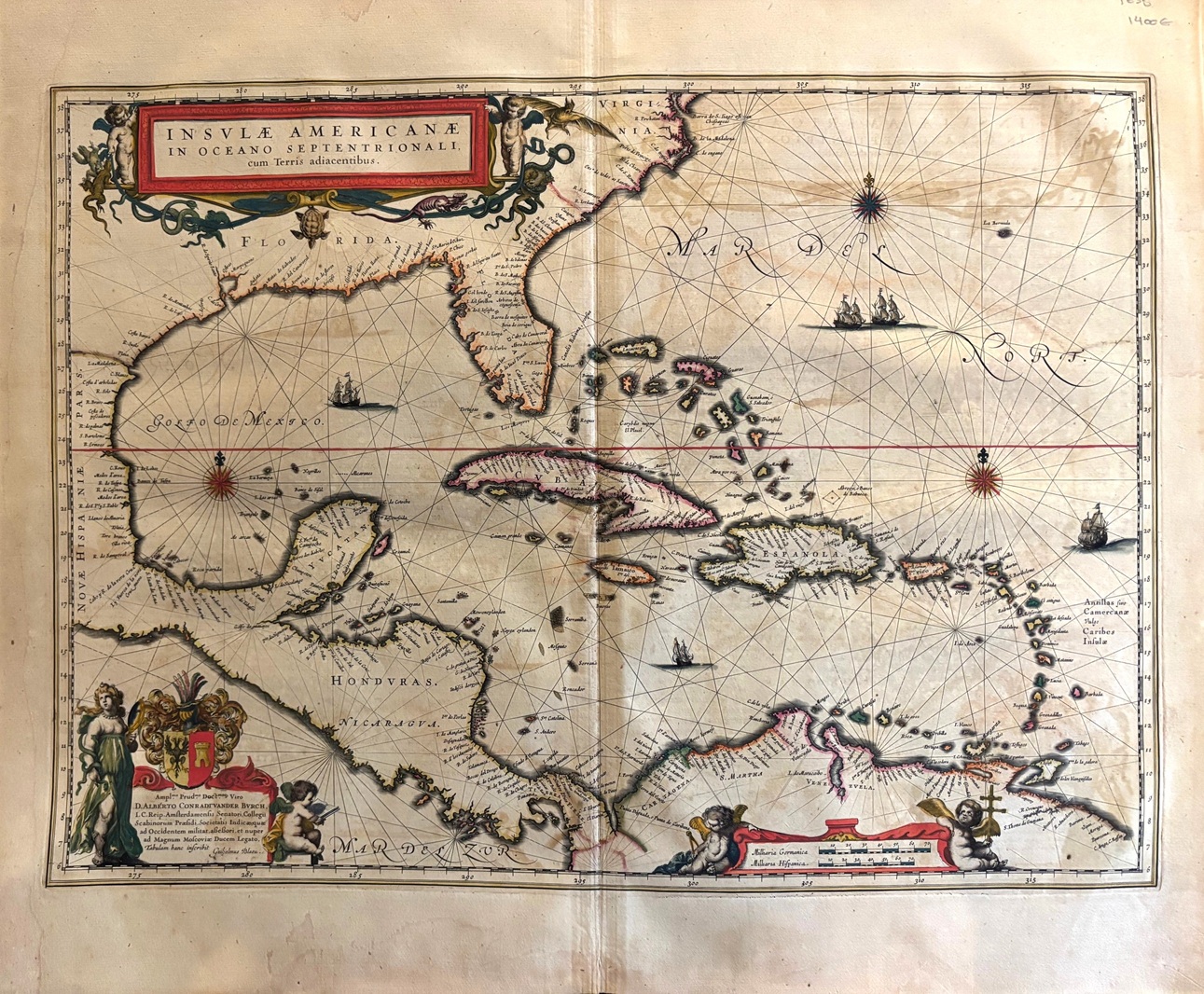
Insula Americana in oceano septentrionalis cum insulis adjacentibus 1635
Condition
Original printed map on laid paper with fine original hand colour. Light offsetting on right side of plate
Colour
Original hand colour
Original map representing the caribbean sea , West Indies, Cuba, Hispaniola, Puerto Rico,Jamaica, Antilles islands . large decorative cartouche with wind rose ,coat of arms, figures,scales, ships and explanatory text. This map comes from the first edition of the Theatrum Orbis terrarum sive Atlas Novus. Blaeu ( 1571-1638) was the most important cartographer and editor of atlases in Amsterdam in the first part of XVII century. He studied with Tycho Brahe in 1596 and acquired a wide knowledge in cartography and cosmography. Since 1608 he began the publication of sea routiers and atlases of the european coasts , globes ,instruments and atlases. In 1630 he published his first general atlas: Atlantis Appendix with 60 maps. he was expanding the atlas in the following years and in 1635 he published in two volumes with over 200 maps the Theatrum or Atlas Novus that was enlarged in 3,4,5 and 6 volumes and several languages ( latin, french,dutch and spanish). This core of maps was the base for the publication of the Atlas Mayor by his son Joan Blaeu from 1662 until 1672.